1. New neotectonic map of Hungary
2. Ambient noise tomography beneath the Eastern Alps and western Pannonian basin
3. New, refined image of the Earth’s crust in the Pannonian Basin
3. Earthquake focal mechanism in Hungary
1. New neotectonic map of Hungary
One of the main goals of the project in 2019 (1ts milestone) was the construction of the new neotectonic map of Hungary completed by the colleagues of Geomega Ltd. The new map is based on the integrated interpretation of the available country-wide 2D-3D seismic dataset, as well as on the critical (re-)evaluation of the results of many published/unpublished neotectonic studies. The new 1:500 000 scale map introduces in a detailed way all important deformation structures (faults and folds) of various origin (tectonic and atectonic) formed during the neotectonic evolutionary phase (<6–8 Ma) of the Pannonian basin. The new map — Wórum, G., Koroknai, B., Koroknai, Zs., Fekete-Németh, V., Kovács, G., Tóth, T., 2020. Young geological deformations in Hungary. Geomega Ltd., Budapest. DOI: 10.17632/dnjt9cmj87.1 — is available for all interested researchers without any limitations using the DOI:
https://doi.org/10.17632/dnjt9cmj87.1
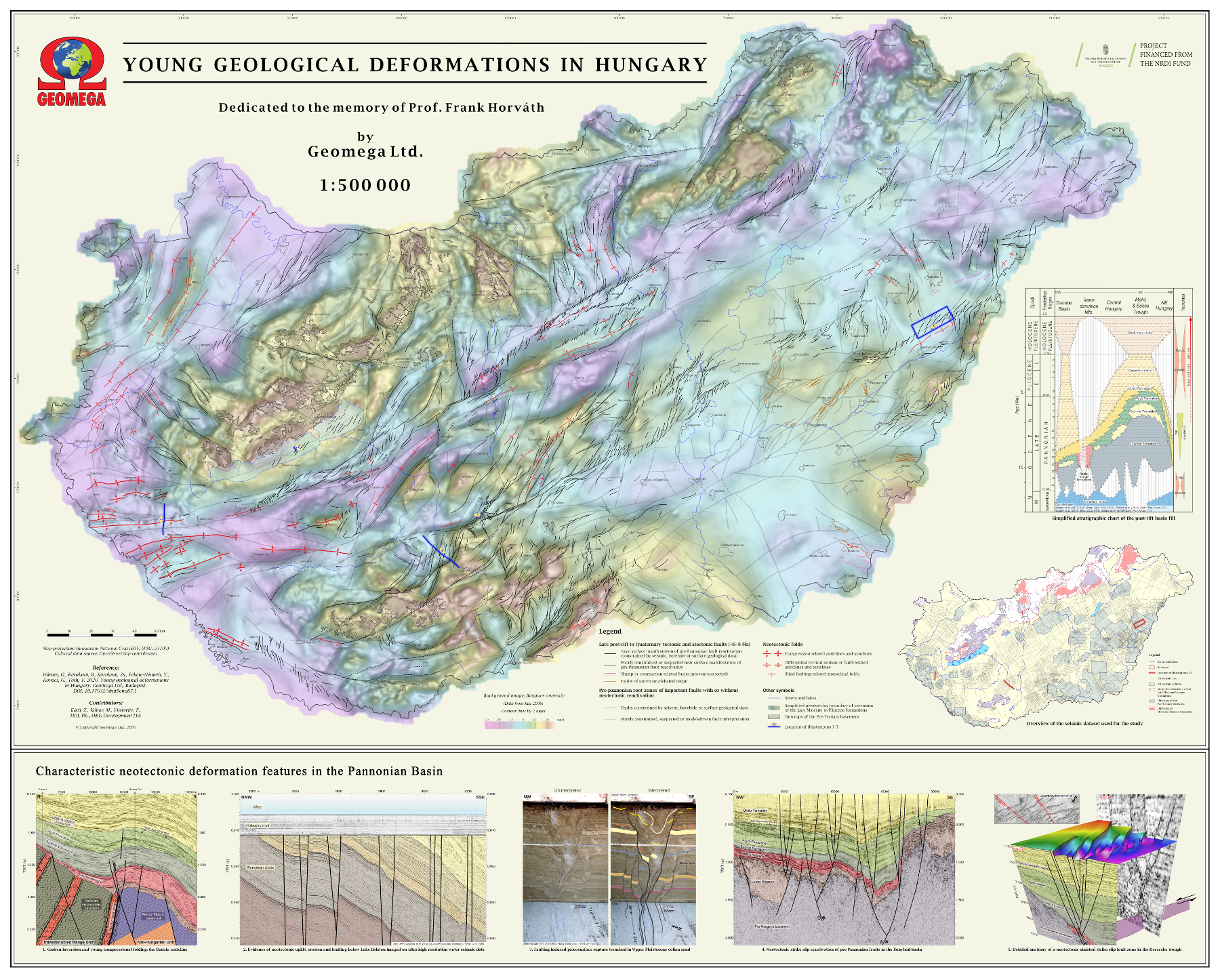
The background and methods of the mapping, as well as its main results are summarized in a new scientific paper published in the journal Earth Science Review (ESR) in November 2020. The paper — Koroknai, B., Wórum, G., Tóth, T., Koroknai, Zs., Fekete-Németh, V., Kovács, G., 2020. Geological deformations in the Pannonian Basin during the neotectonic phase: New insights from the latest regional mapping in Hungary. Earth-Science Reviews 211, 103411; https://doi.org/10.1016/j.earscirev.2020.103411 — is available (pdf) to any interested researcher for request from the authors.
Both the new map and the related paper are dedicated to the memory of our Colleague, late Prof. Dr. Ferenc Horváth, who initiated the project and the new mapping, and who played an outstanding role in the neotectonic research of Hungary and the surrounding Pannonian basin.
2. Ambient noise tomography beneath the Eastern Alps and western Pannonian basin
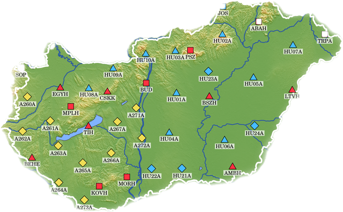
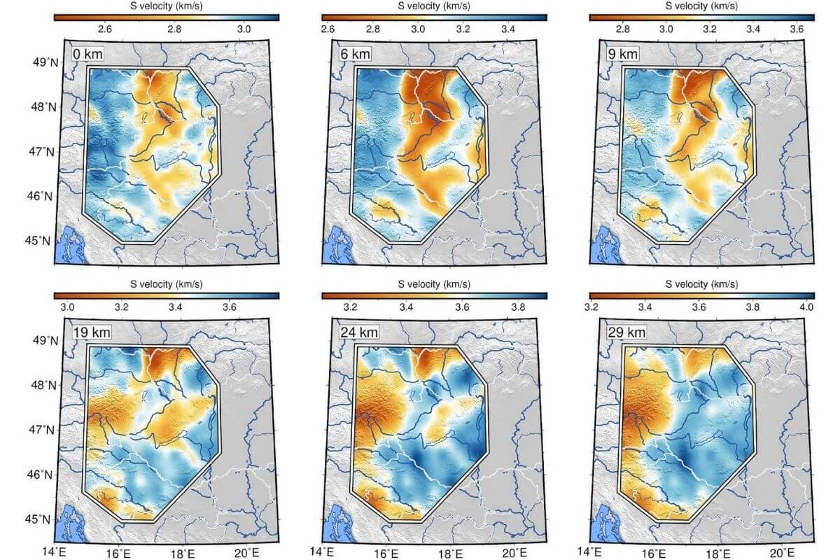
We have established a 3D shear-wave velocity model of the transition zone between the Eastern Alps and the Pannonian basin applying ambient noise tomography. Ambient noise tomography is one of the most powerful methods to image the subsurface using seismic data. Datasets from permanent networks as well as past and recently deployed temporary networks of broadband seismic stations have been processed. After calculating the cross-correlation of vertical component ambient seismic noise, we estimated the Rayleigh-wave group-velocity dispersion curves that were directly inverted for shear-wave velocities. A horizontal resolution of 0.2 degrees in the upper crust and 0.3 – 0.5 degrees in the lower crust was achieved. Our upper crustal shear velocity model shows low velocities in the sedimentary sub-basins and high velocities below the surrounding mountains. However, at greater depths (24–29 km), high shear velocities beneath the basins suggest crustal thinning accompanied by mantle updoming. A detailed description of our tomography results is presented in a scientific paper published in the journal Tectonophysics (Szanyi et al. 2021, doi: 10.1016/j.tecto.2021.228770).
3. New, refined image of the Earth’s crust in the Pannonian Basin
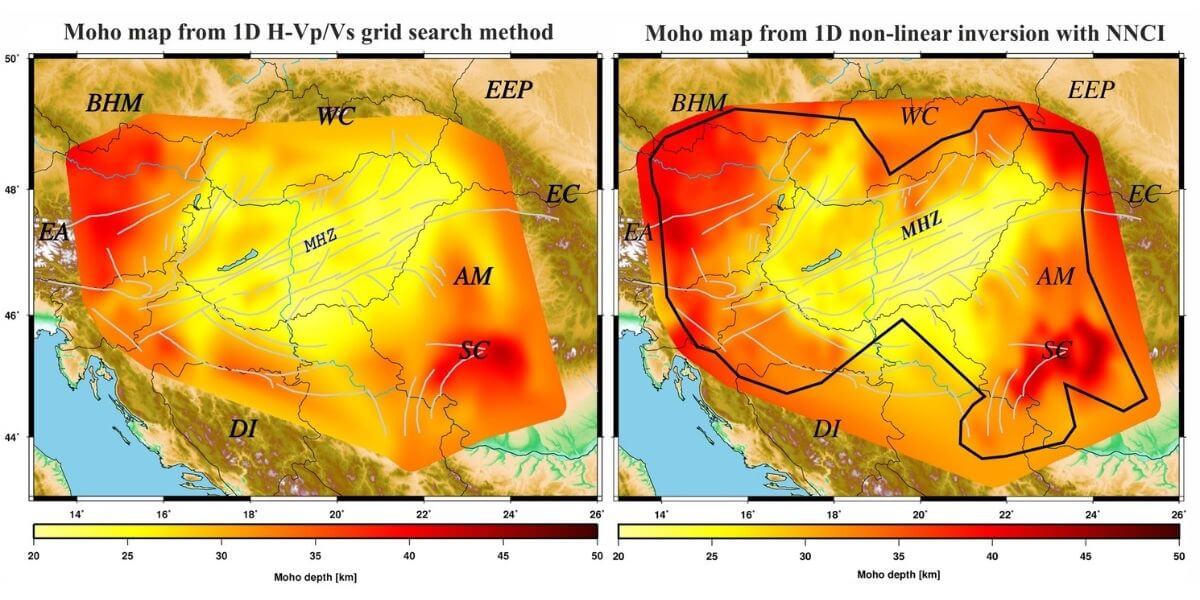
We have improved the 3D image of the sedimentary layer, the upper crust and lower crust in the Pannonian Basin area by the analysis of P-to-S converted seismic waves. The Pannonian Basin hosts deep sedimentary depocentres superimposed on a complex basement structure and it is surrounded by mountain belts. We processed waveforms from 221 three-component broadband seismic stations. Due to the dense station coverage, we were able to achieve so far unprecedented spatial resolution in determining the structure of the Earth’s crust. Among other things, we have constructed new maps of the thickness of the uppermost sedimentary layer, the depth of the Conrad discontinuity (boundary between the upper and lower crust) and the topography of the Moho discontinuity (boundary between the crust and uppermost mantle), as well as the thickness of the upper and lower crust. A detailed description of our results is presented in a scientific paper published in the Journal of Geophysical Research: Solid Earth (Kalmár et al. 2021, doi: 10.1029/2020JB021309).
4. Earthquake focal mechanisms in Hungary
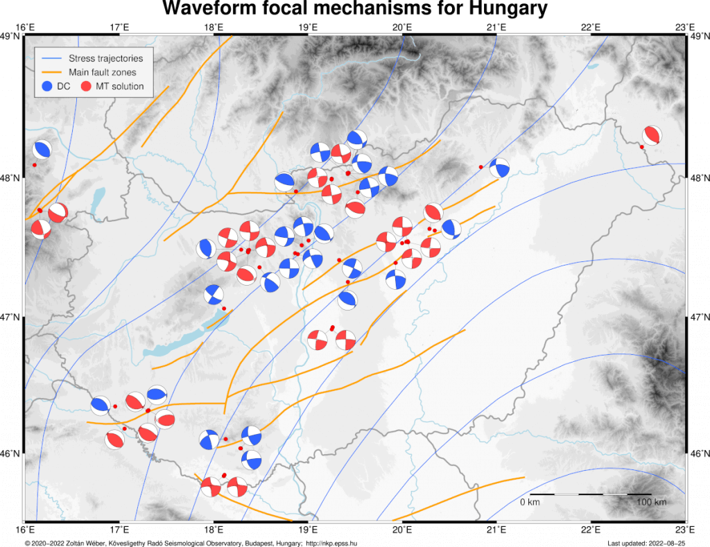
Knowledge of the crustal stress field is essential for understanding tectonics and earthquake generation. One approach for estimating the crustal stress field is based on the focal mechanisms of earthquakes. The focal mechanisms, which indicate the fault plane and slip directions, can be used to infer the structure and kinematics of faults at depth and to constrain the crustal stress field in which the earthquakes occur. One of the main goals of the present project is to construct a reliable focal mechanism database for Hungary and the Pannonian basin.
We use probabilistic non-linear waveform inversion methods to retrieve both the centroids and the moment tensors of local and near-regional earthquakes. The uncertainties of the resulting source parameters are estimated as well. The retrieved moment tensor solutions are robust and of sufficient quality to draw conclusions on the neotectonic features of the epicentral regions.
You can download our regularly updated focal mechanism catalog in PDF form.
